
A volcano that had been silent since around 1550 woke up last summer, and a US-India satellite has been watching it ever since. 🌋🛰️
On July 30, 2025, an 8.8-magnitude earthquake struck off Russia’s Kamchatka Peninsula. Days later, the Krasheninnikov volcano began erupting for the first time in nearly five centuries, sending a steady flow of lava eastward.
Because Krasheninnikov had been quiet for so long, it had little ground-based monitoring. That’s where NISAR came in. From 464 miles up, the NASA-ISRO Synthetic Aperture Radar (NISAR) satellite in polar orbit has returned to the same spot twice every 12 days since late December 2025. Each image shows the ground in about 30-foot detail.
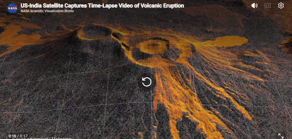
Researchers stitched 17 of those images into a time-lapse. It shows lava filling an inner caldera, spilling into a wider crater, and fanning out across the landscape. Cornell geophysicist Matthew Pritchard said the consistency “shows the promise of NISAR to closely monitor natural hazards.”
Why it matters
Radar sees through clouds and darkness. Frequent, high-resolution revisits can support both science and emergency response for eruptions, earthquakes, floods and landslides.
🇺🇸🤝🇮🇳 NISAR is also a milestone for the US-India partnership. NASA built the L-band radar that captured these images. ISRO contributed the S-band radar and the spacecraft, and launched the satellite from Sriharikota, India in July 2025. The billion-dollar project is the first Earth-observing satellite the two agencies developed together, and it shows how complementary strengths can produce capabilities that benefit the whole world.
As US-India technology ties deepen, from space to semiconductors, NISAR shows what’s possible when both sides bring their best.

